 English (UK)
  Français (FR)
 LOCALITIES
Location map of the photographic collections of the Nubar Library : Ottoman Empire and the Near East
|
This map provides access to the photographic collections of the Nubar Library. For educational purposes, we have chosen to show the limits of the former Ottoman Empire and its vilayets, but also those of present-day Armenia. The photographs cover not only the Ottoman period, but also the reconstruction of the Armenian communities in exile after the genocide and the First World War. To access the photo galleries, click on the localities that appear in the list. The digitization of the collection is in process and will gradually be added to the page. |
| ADANA | 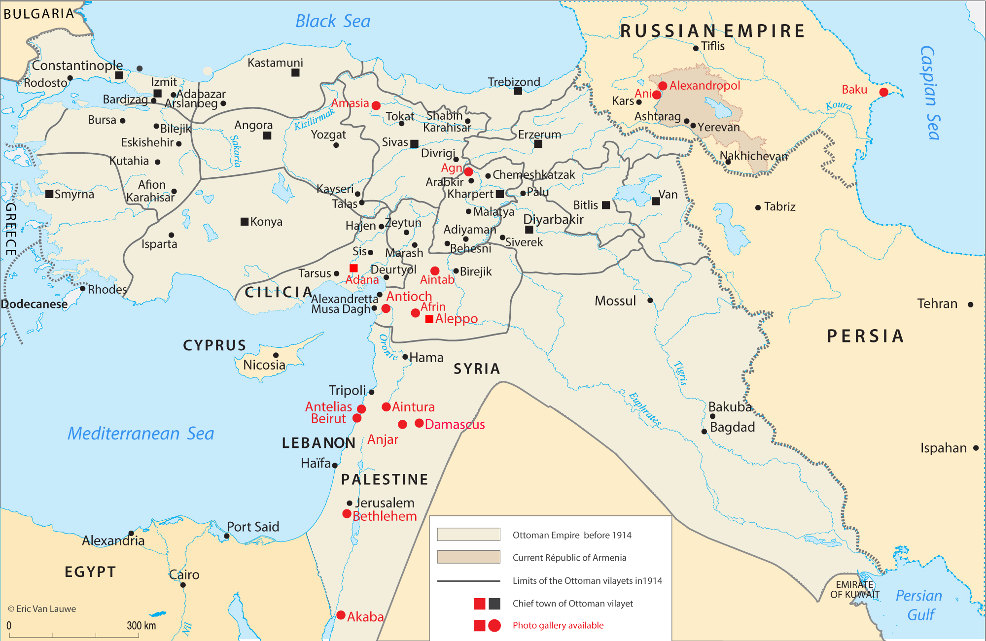 |
| AFRIN | |
| AGN | |
| ALEPPO | |
| ALEXANDROPOL | |
| AMASYA | |
| ANI | |
| ANJAR | |
| ANTELIAS | |
| ANTIOCH | |
| AINTAB | |
| AINTURA | |
| BAALBECK | |
| BAKU | |
| BETHLEHEM | |
| BEIRUT | |
| DAMASCUS |